A B O U T
“Its located on the eastern coast of Suez gulf about 280 km southwards Suez city.”
- AL TOR PORT location is Latitude 28°14’ North and Longitude 33°37’ Its Area 100,000M2, with Sheltered yard 5600 M2.
F E A U T R E S
The port services are confined between:
- General cargo.
- Maritime services.
The Key wall length is 75 M capacity for 380K tons per annum.
Prevailing winds: Northern and North Western winds.
Water Density: 1.040 g/cm³ .
Raining Season: Winter.
Tidal range and flow: 1.3 to 2.3 m.
Future Projects
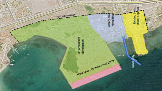
Al-Tor Port basically comprises of the single measures laid down in the port master plan. The master plan for the development of Al-Tor Port contains an area of 464,000 m² that shall be implemented in several successive stages. It includes the development of 1,000 m of quay walls with a water depth ranging from 10-12 m.
C O N N E C T I V I T YRoads Network
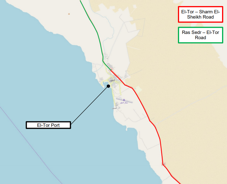
Al-Tor Port is located on the western shore of the Sinai Peninsula, approx. 105 road-km north-west of Sharm El-Sheikh. The port is connected to municipal roads that connect to the regional roads. Those minor roads connect to Suez in north-western direction along the shore of the Gulf of Suez and to Sharm El-Sheikh in south-eastern direction at the shore of the Gulf of Suez.
Road connections to the capital Cairo and to Suez are available. The shortest distance and travel time is made available by use of minor and major roads:
Distance from El-Tor Port to Suez is approx. 285 km northbound along the western shore of the Sinai Peninsula on minor roads.
Distance from El-Tor Port to Cairo is approx. 400 km northbound along the western shore of the Sinai Peninsula on minor roads and then connecting to M50 at Suez. The M50 runs through Suez and finally to Cairo.


