A B O U T
“It’s located on the Mediterranean Sea at the North East of Sinai fare 150 km from East Port-Said.”
At Latitude 31°09’ North and Longitude 33°49’ East
- Since 1987, development was implemented to protect the port seawards, to qualify it to handle dry-bulk, general cargo and export agricultural products, as well as different maritime services and fishing harbor.
F E A U T R E S
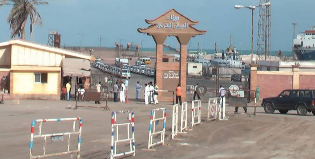
- Al Arish port basically consists of; one dry bulk terminal, one berth of 242 m for dry bulk and general cargo handling, a second berth for service boats (the water depth of the berth is 4m). Mooring facilities are also available for fishing vessels by up to 60 m long jetty.
- The port covers an area of approx. 40 acres, respectively 168,000 m². 56,000 m²are used for open storage of dry bulk commodities. Furthermore, 2 sheds by the joint size of 1,500 m² are available for storing goods sensitive to sunlight and weather.
- After executing the port current development works, the total area will reach 65000 M2and Key wall will be of total length of 369M.
- The handling for General Cargo 1.2 million tons’ annum.
Navigational Aspects
The access channel is 270 m long and 100 m wide. The water depth ranges from 9 m to 11 m. Two buoys are used for navigational assistance. Pilotage is mandatory by the pilots of the Port Authority.
Dry Bulk Terminal
The dry bulk terminal comprises 2 berths of which one is used in half capacity for loading/unloading of general cargo commodities.
General Cargo Terminal
The general cargo terminal at Al Arish port comprises a single berth 50% of which used for loading/unloading dry bulk commodities.

C O N N E C T I V I T YRoads Network
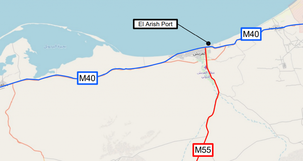
- The port is located East at the Mediterranean Coast of the Sinai Peninsula, approx. 53 km from the Egyptian / Palestinian border at Rafah.
- The port is connected to the International Coastal Road running from East to West. Furthermore, another major road (M55) is linked to the port by municipal roads. This road connects Al Arish with Hasna, which is located about 88 km South of Al Arish.
- The M55 connects the Eastern direction further to Taba at the Gulf of Aqaba (300 km distance from Al Arish) and in Western direction to Suez (255 km from Al Arish). Road connections to Cairo and to Port-Said are available.
Future Projects
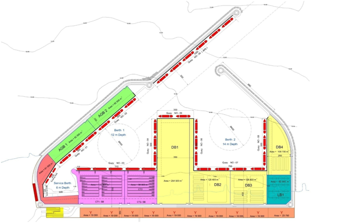
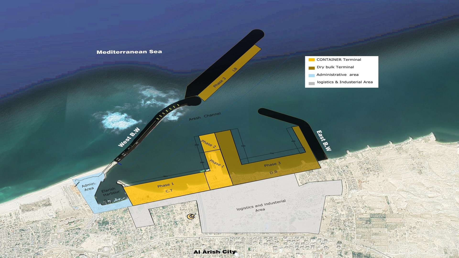
- Al Arish Port masterplan considers plans for a massive expansion with two new port basins and two new water-breakers. Furthermore, it suggests the construction of a container terminal, a dry bulk terminal and a liquid bulk terminal. The existing port will remain as a berth for service vessels.
- The container terminal will be developed in two phases. Phase CT1 features approx. 680 m of quay walls and phase CT2 adds another 460 m of quay walls. The turning basin should have a water depth of 14 m. The dry bulk terminal is supposed to be installed in four phases.
- Phase DB1 and DB2 feature approx. 1,300 m of quay walls each, while phase DB3 will have approx. 540 m and phase DB4 will have approx. 760 m of quay walls. The entire terminal will occupy an area of 425,200 m².
- The turning basin shall have a water depth of 16 m. The liquid bulk terminal is not supposed to have quay walls, but a designated terminal area of 63,300 m².


